The Bale Birding Zones
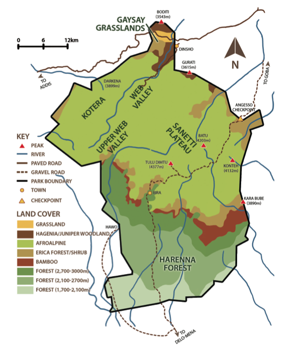
The Bale Birding Route takes you through several distinct habitats of the Bale Mountains National Park: the Juniper woodlands, Gaysay grasslands, Central plateau and Harenna forest. From montane grasslands in the northern Bale Mountains to the Afroalpine ecosystem, the route passes through dry Afromontane forests and continues into the Harenna forest to the southeastern lowland areas. Covering an altitudinal range of 1,800m to 4,377m, the route takes you through two of Ethiopia’s four tropical biomes, namely Afrotropical highlands and Somali-Masai. Six different vegetation types are found within these two biomes. Despite the fact that highlands generally contain lower biodiversity than lowland habitats, over 320 bird species, including half of Ethiopia’s endemic birds and 90% of the highland biome, as well as several of the Somali-Masai biome species, are found in the birding route area. Furthermore, the route includes options to explore unique wildlife and nearby historical and cultural sites, providing you with an unforgettable experience.
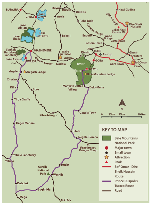
Zone Map:
For a full list of the birds found in BMNP see here.
* Ethiopian endemic , ** Abyssinian endemic
The Northern Part of the Park
BMNP Headquarters (Juniper woodlands)
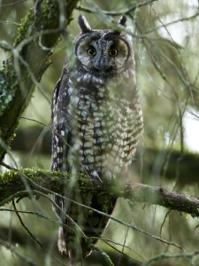
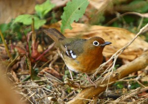
Located at the top of the hill from Dinsho town, this wire-fenced forestland is just over 1km2. It is one of the six remnant patches of dry Afromontane forest found in the northern slope of the Bale Mountains. The vegetation of this forest is dominated by Hagenia abyssinica, Juniperus procera and Hypericum revolutum. The area hosts many birds including the Abyssinian catbird*, white-backed black tit**, yellow-fronted parrot*, gold-mantled woodpecker**, Abyssinian slaty flycatcher**, black- winged lovebird**, montane white-eye, Abyssinian thrush, cinnamon bracken warbler, brown woodland warbler, mountain thrush and African dusky flycatcher. The headquarters is one of the best places in the country to see the Abyssinian long-eared owl, montane nightjar and African wood owl. This part of the park is a great place for viewing the endemic mountain nyala, Menelik’s bushbuck, warthog and occasionally hyena.
Directions and Accessibility: The entrance to the park headquarters is located 1km past the heart of Dinsho Town at the top of the hill on the right-hand side. The entrance gate is located inside the wire-fenced compound where your entrance fee will be collected and local community guides and are available to help plan your trip.
Gaysay Grasslands
This small (20km2) but important zone at the north of the park comprises almost completely flat land at an altitude of 3,000m, with swampy areas that support a diverse avifauna. Here, vegetation is dominated by swamp grasses and sedges of Cyperus and Scirpus genera and low bushes of Artemesia afra and Helichrysum splendidum. This area also offers opportunities to view the endangered and endemic mountain nyala, the most recently discovered large ungulate in Africa, as it harbours 60 percent of the global population. Other fauna includes bohor reedbuck, warthog and grey duiker.
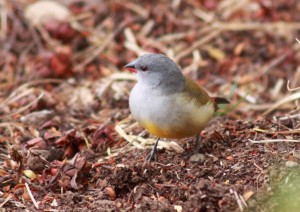
Characteristic species of the grasslands include the Abyssinian longclaw*, black- headed siskin*, the near endemic Rouget’s rail**, Ethiopian cisticola, brown- rumped seedeater, wattled ibis** and white-collared pigeon**. Other easily notable species are the common stone-chat, chestnut-naped francolin, moorland francolin, ground scraper thrush, yellow bishop, common waxbill, yellow-bellied waxbill, alpine chat and streaky seedeater. Several ponds are found in the Gaysay grasslands, where wetland birds including the blue- winged goose*, Egyptian goose, red- knobbed coot, little grebe, common sandpiper, marsh sandpiper and spot-breasted plover* can be found.
Direction and Accessibility: The Gaysay grasslands are located 7km 14 east of Dinsho Town. From the park headquarters, make a left at the main entrance and follow the paved road downhill. Take the dirt road on your right at the disused ticket station and continue about 1km until you reach the guardhouses where you can park.
Adellay Forest
The Adellay forest is located at the southern boundary of the Gaysay grasslands. It is one of six remnant patches of dry Afromontane forest found in the northern slope of the Bale Mountains. With a north-facing slope, this forest occupies an area of 4km2 between altitudes of 3,000m and 3,500m. The vegetation of this forest is dominated by indigenous tree species of Juniperus procera and Hagenia abyssinica at lower elevation, and Rappanea simensis and Hypericum revolutum near the upper tree-limit. The forest patch hosts many birds including the Abyssinian catbird*, white-backed black tit**, yellow-fronted parrot* and gold-mantled woodpecker**, as well as the Abyssinian slaty flycatcher**, black-winged lovebird**, montane white-eye, Abyssinian thrush, cinnamon bracken warbler, brown woodland warbler, mountain thrush and African dusky flycatcher.
Like the Gaysay area, Adellay Forest is a great place for game viewing and photographing fauna such as the endemic mountain nyala and Menelik’s bushbuck.
Direction and Accessibility: The forest can be easily reached either by vehicle or on horseback. However, one must explore within the forest on foot. Follow the same route to Gaysay grasslands. Once parked, cross the road towards the Adellay forest through beautiful mature Hagenia and juniper forest into heather and grass clearings which are dotted with everlasting flowers.
Angesso Forest
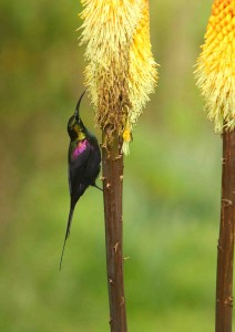
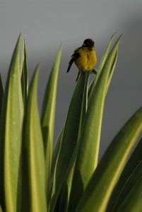
Situated 10km south of Goba town, the site consists of two distinct vegetation zones at the northeastern boundary of BMNP: the upper limit of dry Afromontane forest and the ericaceous moorland. The area covered by trees is outside the park boundary containing scattered trees of Hypericum revolutum, and seasonal flowers such as the highland red-hot poker or torch lily (Kniphofia foliosa) which attract a high abundance of nectarivorous birds such as the Tacazze sunbird and malachite sunbird when they flower, which is usually May to September. The BMNP boundary.
Other birds that may be easily located include: Rouget’s rail**, chestnut-naped francolin, black-headed siskin*, brown-rumped seed-eater, yellow-crowned canary and streaky seed-eater. The forest also offers an outstanding viewpoint over the intricately formed Bale Mountains landscape to the south.
Direction and Accessibility: From the headquarters, turn right out of the entrance towards the towns of Robe and Goba. From Goba continue south on the main road towards the Sanetti plateau climbing through patches of native forest. Once at the BMNP Angesso entrance gate, park scouts will ask for a receipt of your entrance fees (paid at the headquarters in Dinsho).
Central Plateau
Web Valley
This broad, flat valley to the west of the Sanetti plateau and southwest of Gaysay grasslands consists of large areas of swamp and marsh through which the Web River meanders. To the west, the valley is walled by ridges and peaks and to the east by lava cliffs.
Koterah Plain
Located between 3,200m and 3,600m, this area makes up the middle part of the Web valley. The vegetation of this plain includes meadows of red-hot poker (Kniphofia foliosa), and a mixture of Helichrysum splendidum, Artemisia afra bush and Erica spp. on rockier, steep slopes.
Areas of interest to look for birds include the shores of the Web River, specifically near the Finch Habera waterfall (“woman’s urine” in local language), the cliffs at the Meraro campsite for nests and nestlings/nesting raptors and the marshy, meadow pasture at the Sodota Campsite. Koterah plain is an ideal place to see a number of resident and migratory wetland birds, including the wattled crane, spot-breasted plover*, blue-winged goose*, common greenshank, three-banded plover and ringed plover as well as common sandpipers and many others. Like the Sanetti plateau, this area also harbours a high-density rodent community, which attracts many raptors. Black eagle, tawny eagle, greater spotted eagle, peregrine falcon, lanner falcon and augur buzzard are among the raptors easily found.
Direction and Accessibility: From the park headquarters, take the signposted turn near the base of the hill where the lodge is located. It is a rough dirt track, no longer navigable with a 4x4 vehicle but you can walk or ride. The first 8km or so pass through local farmland along the edge of the park. Then you enter the park, and settlements and crops begin to thin out. 12km after leaving the headquarters the road travels parallel to the Web River, skirting an impressive gorge. At the top of the gorge the road crosses a stone bridge over the Web River, and rises steeply. At the top of the rise, 200m further on along the road you will again cross the Web River. Here, the road enters a large open expanse of Afroalpine habitat. As you cross the Web River again, 50m downstream is the Fincha Habera waterfall. The Web valley road continues across the open Afroalpine plain, and 18km after leaving the headquarters the road ends.
From here, it is possible to make an excursion or spend the night camping either in the Habera campsite at the base of the falls or at the flat valley 4-6km away where the Sodota Campsite is located.
Upper Web Valley
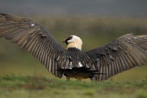
The southern, or Upper Web Valley, is characterised by Afroalpine vegetation similar to that of the Sanetti plateau. In addition to most of the birds that can be observed at Koterah, this site offers the opportunity to observe nesting sites of raptors such as the bearded vulture at the Keyrensa cliff. It is also one of the best places to view the Ethiopian wolf, found only in six isolated mountaintop regions in Ethiopia.
Direction and Accessibility: For exploring the Upper Web Valley, plan on camping three to four nights and trekking five to six hours per day on the following routes: from Habera or Sodota to Keyrensa to Rafu and Gebre Guracha (Black Lake). End your trip on the Sanetti plateau where you can take public transportation back to the park headquarters, arrange a car from Goba, or head down to the Harenna forest where you can camp at one of the designated campsites or stay in the Bale Mountain Lodge.
Afroalpine Wetlands
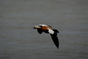
Afroalpine wetlands, in this context, refer to alpine lakes and highland streams and marshes. These water bodies, found above 3,800m, are key features of BMNP, and in addition to their vital habitat and ecosystem services are an attractive scenic feature in their own right. The many alpine lakes at this site offer the opportunity to see many aquatic birds including the ruddy shellduck, which is the most southerly breeding population of the species in Sub-Saharan Africa. Also present is the blue-winged goose*, the rarest and most isolated goose in the world. The Egyptian goose, yellow- billed duck, African black duck, northern shoveler, African snipe and common snipe can also be seen. Furthermore, the marsh and stream areas are a suitable habitat for a considerable number of the vulnerable wattled crane.
Direction and Accessibility: See directions below for the Sanetti plateau. Continue on the same road through the Erica forest/moorland from Angesso to where the Erica vegetation ends and is replaced by Afroalpine moorland characteristic species such as various dwarf Helichrysum spp. a tree-sized giant herb, as well as giant lobelia, reaching a height of up to 6m. Several lakes and marshes exist along the roadside where birds can easily be spotted.
Sanetti Plateau
The Bale Mountains National Park contains the largest patch of Afroalpine land on the continent. With an altitude above 4,000m, the Sanetti plateau is the flat mountaintop of the Bale massif, which is covered by Helichrysum moorland dotted with giant lobelia. The highest point in the Bale Mountains and second highest point in Ethiopia rises from the plateau: Mount Tulu Dimtu stands at 4,377m. The Afroalpine area of BMNP is the main refuge for the endangered and endemic Ethiopian wolf; with a total global population of less than 450 individuals, it is the rarest canid in Africa. Over half of the population is found in the Bale Mountains National Park. The area is also a home to over 13 rodent species including the entire global population of the giant molerat.
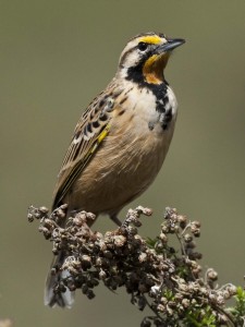
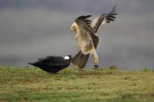
Apart from serving as the wolves’ food, the high abundance of rodents in the area attracts many species of raptors. Special raptor species frequently seen include the steppe eagle, tawny eagle, black eagle, golden eagle, greater spotted eagle, lesser spotted eagle, augur buzzard, long-legged buzzard, lanner falcon, peregrine falcon, pallid harrier and bearded vulture (lammergeyer). In addition to raptors, other groups of birds often easily spotted are the spot-breasted plover*, black-headed siskin*, Abyssinian longclaw*, thekla lark, ground scraper thrush, red-breasted wheatear and alpine chat, all of which are common species located with little effort.
Direction and Accessibility: From the park headquarters the total trip is 54km. From Dinsho make a right out of the Park headquarters and follow the asphalt road. After 30km you will reach the town of Robe; after another 12km you will pass through Goba. From Goba it is a further 12km to the beginning of the Sanetti plateau.
Southern Forest
Harenna Forest
The southern and largest area of the park consists of the second largest forest in Ethiopia: the Harenna forest. Along with the adjacent State- and community-managed forest outside the park, it constitutes an area over 4,000km2. The forest supports a variety of plants and animals along its vegetation gradient, such as the dwarf Erica zone (3,300m - 3,900m), the Hypericum-Rappanea-Erica Belt (3,000m - 3 ,300m), the Hagenia- Hypericum belt (2,600m - 3,000m), the Prunus-Schefflera-Hagenia belt (2,000m - 2,600m), the Aningeria belt (1,600m - 2,000m), the natural coffee zone (1,400m - 1,600m) and the Combretum-Terminalia woodland (below 1,400m).
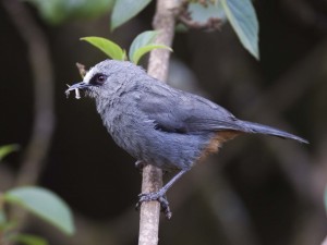
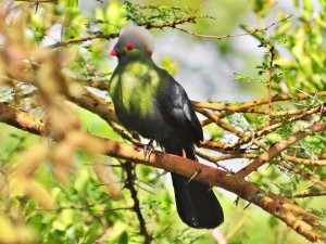
The Harenna forest is the second largest forest in Ethiopia and the largest cloud forest in the country. Although avifauna is elusive here, it is the best place to find several forest specialist birds. The highlights of the forest include the Abyssinian catbird*, Abyssinian oriole** and yellow-fronted parrot*, and various forest specialist birds including the white-cheeked turaco, Sharpe’s starling, Abyssinian crimson-wing, collared sunbird, yellow-bellied sunbird, African hill babbler and silvery-cheeked hornbill. Other birds to look for include lemon doves, tambourine doves, red- chested cuckoo, emerald cuckoo, narina trogon and grey woodpecker.
The Harenna forest is not only suitable for bird watching, but also a good place to view several unique mammals. Almost the entire population of the Bale monkey is found within the Harenna forest. Menelick’s bushbuck and giant forest hog are easily observed along roadsides. Very lucky visitors can come across unique populations of lion and African wild dog.
The best way to explore the forest is to either stay at the Bale Mountain Lodge in the Katcha clearing or camp at one of the designated campsites. From the forest, you can listen for the Abyssinian long-eared owl, wood owl and Abyssinian nightjar.
Direction and Accessibility: The road across the Sanetti plateau is one of the highest all-weather roads in Africa. The 45km drive across the plateau takes about one hour. Continue on this road through the Harenna escarpment where the altitude drops from 4,000m to 2,000m in a distance of just 8km. The road then winds through the small village of Rira and into the Harenna forest. A further 7km on that road leads you the Katcha clearing and Bale Mountain Lodge. There are also designated campsites in the forest.
Bale Lowlands
For a full list of the birds of Dire Sheik Hussein and Sof-Omar, click here.
Sof-omar
With a total length of over 1.5km, Sof- Omar is one of the longest underground cave systems in Africa. The cave and its entrance area are named after a Muslim holy man who lived in the cave with his daughter.
The area is part of the Bale lowlands and is characterised by a semi-arid ecological zone containing mainly Commiphora- Kirkia-Acacia woodland and bushland vegetation types. This area hosts mostly Somali-Masai Biome assemblages.
The cave is remarkable for its cathedralesque carvings and slender passages. The full walk through the caves is 1.7km and takes around three to four hours. From December through May, the river is low enough to cross although water can be waist deep in some places. Look out for the bats that hang overhead and the eels that live below.
Interesting birds one can easily spot include the white-bellied go-away-bird, Somali long-billed crombec, Egyptian vulture, shining sunbird, Hunter’s sunbird, Fischer’s starling, brown-tailed rock-chat, bristle-crowned starling, black- throated barbet and African orange-bellied parrot. Furthermore, Sof-Omar is the best place to see the range-restricted and vulnerable Salvadori’s seedeater.
Direction and Accessibility: Coming from Goba, take the right turn in Robe Town at Waqo Gutu roundabout and drive, on a good dirt road, towards the small town of Goro. From here, descend into the valley of Sof-Omar. Continue to where the road crosses the valley bottom, and at the apex of the U-turn keep an eye out on your right for “Sof-Omar” painted in faded red on a rock, just before the road takes a harsh left that takes you down the valley of to the cave. The caves of Sof-Omar are 96km from Robe.
Dire Sheik Hussein
The shrine of Sheik Hussein was named after Sheik Hussein Bin Malka who was renowned for his religious teachings, high devotion and miraculous deeds. The shrine is over 900 years old and contains over 11 mosques. Like Sof-Omar, it is also a popular place for worship, attracting thousands of pilgrims from all over the country.
The vegetation and climatic conditions are similar to that of Sof-Omar, and the biome is mostly Somali-Masai. In addition to several of the birds found in Sof-Omar, other birds that can be found in the Sheik Hussein area are the boran cisticola, red-naped bush-shrike, rosy-patched bush-shrike, Abyssinian ground hornbill and shining sunbird. It is also the only other alternative site to observe the Salvadori’s seedeater besides the Sof-Omar area in the Bale Region.
For a full list of all birds in the Sof-Omar and Dire Sheik Hussein areas please see here.
Direction and Accessibility:From Sof-Omar Cave, continue 158km on the same road to Dire Sheik Hussein through the beautiful Ardatere Valley to Ginnir town and further towards Delo Sebero junction, where the road splits in two. Take a right turn from here where a good dirt road takes you to small town called Jarra. Continue through the stunning views of the Gubayeu Mountain to Dire Sheik Hussein.
Prince Ruspoli’s Turaco Route
From the Bale Mountains, head south to Delo-Mena - where the earth is red and camels are abundant - to Negele-Borena, a lively, lowland town. Continue on to the isolated Geralle National Park and the untouched southwestern part of Ethiopia, reaching the Yabelo Wildlife Sanctuary en route to the home of Prince Ruspoli’s turaco, as you continue to the south or return to Addis.
Direction and Accessibility:Leaving behind the moist tropical forest, drive 50km south to Delo-Mena. Delo-Mena is known for its coffee and offers basic accommodation. The next morning, drive through grasslands and the Genale Valley to Negele-Borena, a large, bustling town. Take a right turn at the junction of Haymi Refu village and drive through scrubland to the Geralle National Park; you may encounter dik-diks running along the road on the way. The park headquarters is located in a small village called Oudet. The park was established in 2006 and is about 4,000km2. After obtaining your entrance permit, continue on the same road for three to four hours to the entrance. Continue through bush and grassland to Direre Wilderness Campsite, located close to the Dawa River and encircled by large riverbank trees. After a brief rest in the campsite, set off in search of wildlife including kudu, oryx and gerenuk. Keep an eye out for elephants, often seen drinking from the Dawa River.
There are several options for your next destination:
Option 1: Continue further on the same road to Arero via Wichale Village, considered the best place to see the Prince Ruspoli’s turaco - first discovered in 1892 and not seen again until the 1940s. There is a rough road that takes you to Yabelo where you can spend the night; it is advisable to check the road conditions beforehand.
Option 2: Drive towards Yabelo and en route explore the village of El Sod. Known as the “House of Salt,” El Sod is famous for its deep crater lake, out of which muddy, black salt has been extracted for centuries. Continue to Yabelo, home of the Stresemann’s bush crow and the white-tailed swallow. The Stresemann’s bush crow is found in groups of up to 30 birds and is considered to be quite enigmatic. The acacia bush areas around Yabelo feature many birds which are near endemic to northern Kenya and southern Ethiopia. Yabelo is the largest town between Dilla and the Kenya border town Moyale. It is one of the country’s premier birding sites due to high diversity and endemism that combine to offer a superb birding experience.
The 272km asphalt road from Yabelo to the Southern Nations Nationalities and Peoples Region capital Awassa takes you through the acacia scrub of the southern Rift Valley and fertile highlands. The road then takes you towards Yirga Chaffe, where some of the best coffee in the world originates. From there continue to Dilla, where around 80 traditional stellae (carved stones) are featured at Tutu Fella. The drive then continues on to Yirgalem, the gateway to the newly established Loka Abaya National Park and the Aregash Lodge, one of the best lodges in the country built using local materials in the style of a traditional Sidama village. The Loka Abaya National park is located on the northeastern side of Lake Abaya about 50km southwest of Awassa. It covers an estimated area of 500km2. At present the main attractions of the park are the views of Lake Abaya and the riverine forests. Here, you can camp at a temporary campsite at the park headquarters.
From Yirgalem it is only 40km to Awassa on good asphalt road. Fresh pineapples and colorful sidama basketry - made of papyrus grass - can be found along the roadside. One of Ethiopia’s most attractive cities, Awassa is known for its scenic lake. Continue further north among the central Rift Valley lakes to Addis passing through Shashemene, best known for its Rastafarian population. Past Shashemene is Lake Langano, Ethiopia’s most developed lake destination with a number of quality lodges and lakeside resorts. Drive further through the small and bustling town of Ziway, known for a lake of the same name with five little volcanic islands. Many white pelicans and yellow-billed storks dwell on its shores. From Langano you can continue on to Mojo where you make a left turn towards Addis; a four hour drive.
Wabe Shebele Gorge
The Wabe Gorge forms the watershed boundary of the Wabe Shebele River, which is the longest river in southeastern Ethiopia. The best site from which to view this breathtaking scenery is near the town of Gasera (60km north of Robe).
Birds of interest inhabiting the gorge include the near endemic white-billed starling**, bearded vulture and several other species.
Direction and Accessibility: From the shrine of Sheik Hussein, continue 25km to the Wabe Gorge, consisting of three smaller gorges, arguably the most dramatic in the country. The road takes you from the 1,000m high edge down to the river on narrow winding roads. There are good camping grounds around the first and second gorge; it is also possible to camp at the Culture and Tourism Office in nearby Dire Sheik Hussein.
